An Introduction to Photogrammetry: How to Create 3D Models from Photos
Have you ever wanted to create a 3D model of an object, but weren't sure how to go about it? Photogrammetry is a technique that allows you to do just that, using nothing more than a series of photographs. In this blog post, we'll take a closer look at what photogrammetry is and how it works, as well as some of the ways it can be used.

Did you know? : Photogrammetry is different from LiDAR scanning from the back of your iPhone but both methods can provide a detailed 3D model !
What is Photogrammetry and how does it work?
Photogrammetry is the science of using photographs to measure and create 3D models of objects or scenes. It involves analyzing the images to determine the positions and distances of the objects in the scene, as well as the orientation and movement of the camera.
The photogrammetry process involves several steps:
Capturing photographs: The first step is to take a series of photographs of the object or scene you want to model. It is important to capture photos from various angles to create a more complete and accurate representation. This can be done with DSLR camera, Drone, or even your phone camera!
Extracting features: The next step is to identify and extract distinctive features from the photographs, such as corners or edges. These features are used to align the images and calculate the positions and distances of the objects in the scene.
Aligning the images: Using the extracted features, the images are aligned and a 3D point cloud is created. A point cloud is a collection of points in 3D space representing specific locations in the scene.
For 2. and 3. you can use commercial software for the calculation, or if you have an iPhone, Apple has a useful API for you to create your own program! stay tune for more detail.
Building the 3D model: Finally, the point cloud is used to create a 3D model of the object, including dense cloud, mesh, or even voxel.


Applications of Photogrammetry
Photogrammetry has a wide range of applications in fields such as surveying, mapping, architecture, and engineering. Some examples include:
Creating 3D models of objects or scenes for virtual reality, augmented reality, or 3D printing - Metaverse for everyone!
Mapping and surveying large areas, such as forests or cities
Generating point clouds of building or object for digitalization, including preservation, inspection, or evaluation.
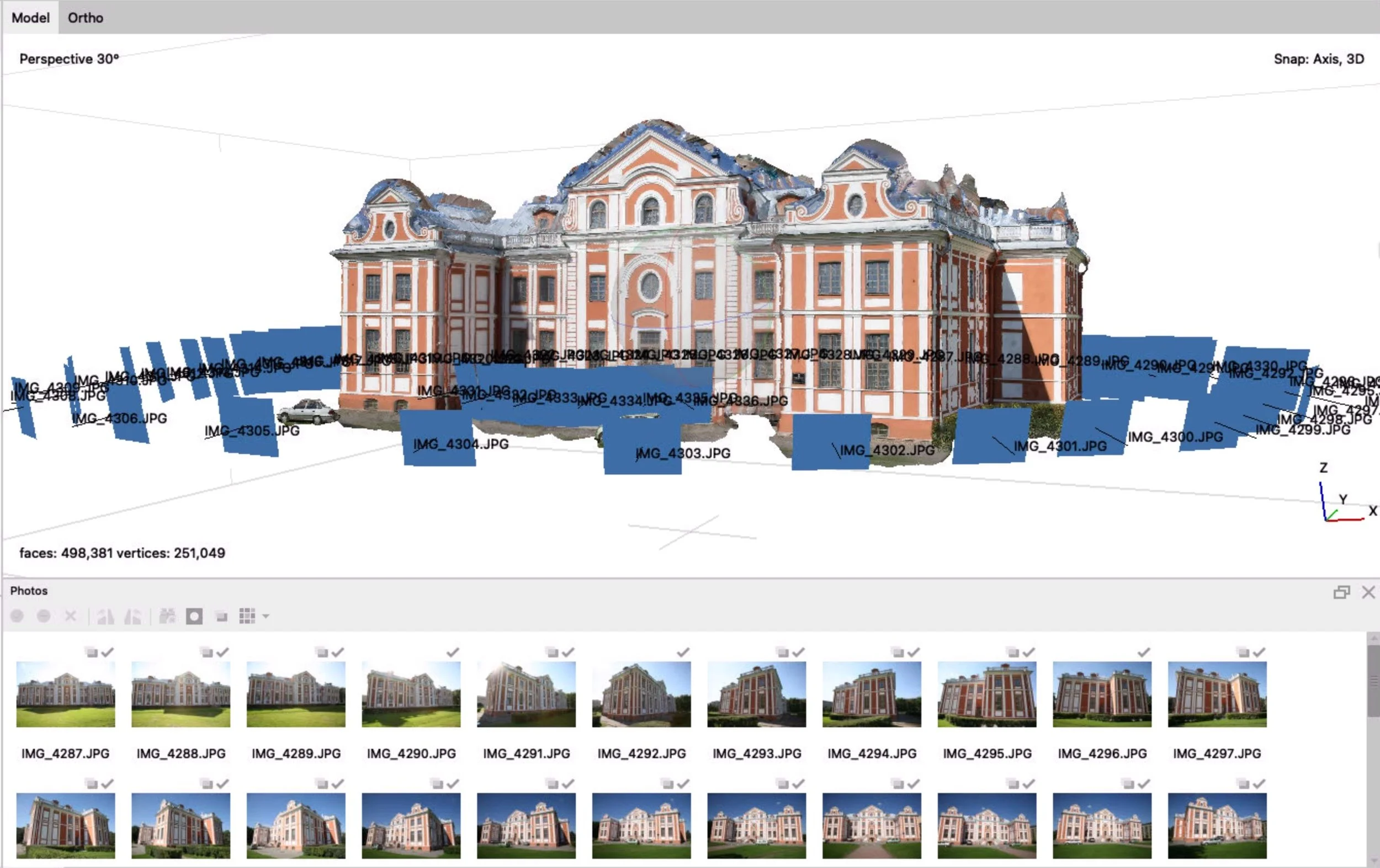
Example of photogrammetry usage on 3D reconstruction of building. Credit: Demo file “Building“ from Agisoft. Built using Metashape Pro software on M1 MacBook Air.